Places, Earth
xxxx
xxxx
|
|
Places, Earth
xxxx |
|
|
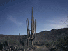
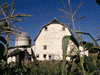
I had been wanting to do the Underground Sacramento tour for some time and decided it was time. We had spent a few hours in Sacramento the summer before, but there wasn't time for Old Town. I had canceled this trip a few times before, so I was hoping the trip would be successful. I also wanted to ride a train from the California State Railroad Museum, but was told they wouldn't resume for the season for a few more months. Day One: Traveling North We left just after 8:00 AM heading north on I-5. The recent rains allowed the hills to be a bright green, a contrast to late summer and fall when the same mountains are brown. We stopped at Tajon Pass Rest Area, skipped Buttonwllow Rest Area, hoped to stop and Coalinga-Avenal Rest Area but it was closed, then we stopped at the newly renovated John C. Erreca Rest Area. We stopped for gas in Santa Nella and lunch at Pea Soup Andersen's. We try to stop at Pea Soup Andersen's while traveling I-5 and have a collection of their soup mugs. It was Valentines Day, so we splurged for an appetizer assortment in addition to the main meal and a cup of pea soup. I enjoyed my lunch, but did something I don't usually do, it was too much and I didn't finish. We bought two cases of pea soup. As we traveled north on Interstate 5 through the San Joaquin Valley, along the way, there we many signs asking the governor for more water for agriculture, although climate change and less precipitation are the cause for the water shortage. We also passed miles of what I think were almond trees covered in bright while blossoms. Eighty percent of the world's almonds come from California, most from the Central Valley. We arrived in Sacramento a little after 3, found parking, and entered Crocker Art Museum. We only had an hour and a half to wander the galleries, mostly the third floor. The galleries lead one to another and we think we saw all the galleries. The museum has a good cross-section of art styles and we enjoyed the exhibits. I particularly liked the labels, most, in addition to the usual title and artist, also had a description of what the subject is and the artist's intent. Most art museums don't do this and I'm left wondering about what bridge, why? Some type of event was letting out between the museum and the hotel and sections of streets were closed, but eventually we checked in and settled in for the night. Day Two: Old Town We slept well, got ready, and ate. I decided that the church I planned to attend was going to involve difficult parking, so I found one further, but earlier and easier parking. My wife rested while I attended Mass. Old Town Sacramento is less than a mile from the hotel, but took about five miles round trip following a convoluted route to reach it. We parked easily at a structure a few hundred feet from the California State Railroad Museum which would be our last stop. It was 10:00 am and we had an hour and a half to wander the Sacramento History Museum before our Old Sacramento Underground Tour. There were several interactive demonstrations of printing, block printing, and other activities. In honor of the Chinese New Year and the Year of the Horse, several of the activities fit this theme, printing horse images and Chinese lanterns, paper folded envelope for a Chines 'lucky coin,' and others. At 11:30 our tour began. After the introduction, we were given a sound system to wear and we began walking south while the guide told us about the history of Sacramento. The city is built beside a river that oven floods. There were three solutions to the problem, build a levee, raise the buildings, or move the river. The city decided to do all three. Some buildings simply buried the first floor and converted the second floor into the first floor, some buildings were demolished and rebuilt at a higher base, and most were raised. Beams and jacks were installed under the buildings and using jacks and cribbing, the buildings were raised a few inches a day until the entire building was one level higher. Hundreds of buildings were raised this way, some quite large. The streets were raised but it took a while to raise the sidewalks between, requiring the use of many ladders to climb down to the original sidewalk and back up to the buildings. We explored the lower levels of two buildings which included walls, columns, and displays of artifacts found under the buildings. Back on the new street level, we walked a few blocks for a nice Mexican lunch. I ordered Santa Fe salad and my wife ordered Flautas. From here, we walked to the Sacramento River and then upriver a few blocks, then finally to California State Railroad Museum. We joined a thirty-minute tour that lead us through the history of railroads in California. Unlike most railroad museums that I have visited, which are outdoor collections of lots of equipment, often in poor condition, this is more selective of mostly beautifully restored equipment all under cover in a beautiful building. The third floor is dedicated to toy trains and model railroading. I use to model railroad and it brought back happy memories, but a little frustration that I just don't have the time any more. From here, we returned to the hotel and settled in for the night. Day Three: Race for Home We slept well, got ready, ate. and departed. There was a light rain as we left and it rained lightly to heavily most of the way home, visibility from a few hundred feet to a few miles. We were worried that if it got colder, snow might close the pass and we'd need to take a two hour detour. We got gas in Santa Nella at the same station as we did on the way up two days earlier. We tried to stay ahead of the storm as it moved south and fortunately, the pass was open amid a light rain. We skipped a few rest areas, a few were closed, and we stopped at Coalinga-Avenal and Lebec. It stopped raining a half hour before arriving home a little before 2:00. Our four-footed family was glad to have us home. |

|

|

|
| Note:This is not the official site for any of the places shown in Places Earth. Places Earth is not responsible for accuracy of the information. Hours of operations, prices, exhibits, and sometimes locations are subject to change without notice. |
|
Links |

|
This site maintained by Kenneth A. Larson. Copyright © 2004 - 2023, Kenneth A. Larson. All Rights Reserved. Website content including photographic and graphic images may not be redistributed for use on another website. |

|

|

|