Places, Earth
Yellowstone National Park, 2026
Yellowstone National Park, 2026
|
|
Places, Earth
Yellowstone National Park, 2026 |
|
|
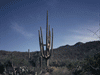
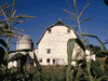
Day One, Open Landscape and Trains: My wife and I had been talking of visiting Yellowstone for as long as we had been together. I planed the trip, she oked it, and when it was too late to cancel, she canceled. Once again, it was Isabel, Douglas Adams, and myself on an adventure. It's just as well that my wife canceled because Isabel, my Mustang, was so full, there wouldn't have been a place for my wife and her things. I finally got off at 5:59, only 59 minutes behind schedule. I headed east on the I-210. A septic cleaner truck with loose white plastic buckets passed me. I allowed some distance ahead of me. A few minutes later, I saw a white plastic bucket bouncing along the right shoulder. It pays to pay attention. A little light rain near Claremont. I reached I-15 a minute after 7:00 and then north through Cajon Pass where I encountered some fog. My favorite radio station was fading so I inserted the last disk of So Long and Thanks for All the Fish which was where I left off at the end of the previous trip a few weeks earlier. I noticed Liberty Sculpture Park a little east of Barstow/ Yermo, maybe I'll have time to stop one day. I finished So Long and Thanks for All the Fish about fifteen minutes before stopping at Clyde V. Kane Rest Area (8:30). Only one of the three sinks worked. Before moving on, I loaded Mostly Harmless which was still playing when I reached Ely. I passed Baker with its worlds tallest thermometer, easily seen from the highway. The next rest area was closed. I observed a large solar plant to the north. I crossed into Nevada at 9:38 were a large hotel/casino complex begins almost at the border. There is a huge gas station here, but I still had a third tank, so I pushed on to get gas in North Las Vegas which easily got me to Ely. Passing through Las Vegan, I noticed a garish gold tower with red lettering standing by itself close to the highway. I transitioned to US 93 a little before 11:00. More solar panels lined the road. I entered Lincoln County, home to Area 51. I kept an eye out for ETs. Aside from a few small towns about midway, this was the loneliest road I've ever driven, Over two hundred miles with just the cluster with one hundred miles of empty on either side. I was surprised when I entered Nye County since I had driven this county before, but much further west. I turned left onto Highway 318 which was one hundred miles of empty landscape. I was relieved to find a rest area in the middle of nowhere. The most empty I have ever seen. I crossed into White Pine County where I would be until the following afternoon. I got to the Northern Nevada Railroad Museum at 2:20, just as a train was returning. The next train was at 4:30, so I had a little time. I wandered the site and the engine house for an hour photographing equipment, then checked into my hotel, just a mile or two away. I unloaded quickly, used the bathroom, drove a few blocks to the hardware store, and was back at the museum by 4:00. The train left at 4:30, first backing off the siding that leads to the station, then switched to the main line, then forward. The train travels about 7.5 miles west, belching out black smoke as it pulled the train up the grade. We passed through a tunnel that doubles as a fallout shelter because of he atomic test site a few hundred miles south. Part of the route runs beside I-50, past old mines, and turned around at Ruth using a 'Y'. On our return, the Conductor pointed out the oldest brothel in Nevada - I had other plans for the evening. The train returned about 6:00. I found a grocery store for something I had forgotten, got gas, and returned to my hotel about 7:00. I settled in for the night, ate dinner, and organized my photographs and notes. Day Two, Ward and Great Basin: I slept well, got ready, and relaxed until time for church. I attended Mass at Sacred Hearts at 9:30 and got back to the hotel to checkout at 11:00. I was a little concerned about my Mustang on the 7 mile unpaved road to Ward Charcoal Kilns, but it wasn't bad and I had no trouble at 35 MPH. I paid the fee and walked the few hundred feet to the six kilns, considered to be among the best preserved. I had seen charcoal kilns before in Death Valley and near Owans Lake, but those are not as well preserved as the kilns at Ward. I took a few photos of the exteriors and then entered the first. I immediately noticed the echo of my feet on the gravel floor. I entered each, only the second one shows damage at the top. The kilns are of stone with an access hole on one side, many small air holes around the base, and a large hole at the top, They are all about the same design and condition, but I entered and photographed each. Then I walked a few hundred feet of the trail and took some photos looking back at the kilns, I didn't have time for a three mile hike, so I pressed on. It didn't take long to reach my other main stop, Great Basin National Park. Along the way, I noticed a few snowflakes and a wind farm of many wind turbines. Great Basin National Park is one of the more remote National Parks, in the middle of the eastern edge of Nevada, hours from any major city. First I stopped at the Great Basin National Park Visitor Center in the small town of Baker. Had I not canceled last year, I was going to stay in Baker, but then I learned of the railroad museum in Ely and the Ward Charcoal Kilns near Ely. It just worked better for my schedule to stay in Ely. I entered the only road into the park which leads almost to the top of the mountain. There are two vista points along the way, I stopped at both. As I approached the top at about 10,000 feet, there were a few snowflakes, and a short hike. At the end of the road (actually the last mile or two was closed) there is a three mile trail to the Bristle Cone Pines, among the oldest trees on the planet. Because of the weather, the trail was not advised and I didn't have time anyway. I made a last stop at the Visitor Center. Once back at basin level, I headed east along another lonely highway. A light rain started falling, but it was a moderate rain by the time I reached my hotel in Provo. As I headed east, I finished Mostly Harmless. I crossed into Utah at 3:18 PDT/4:18MST. The rain started falling a little harder. The rocks are interesting, an introduction to the beautiful geology of Utah. I had forgotten to bring Hitchhiker's Guide to the Galaxy (the first book in the series), so I started over with Restaurant at the End of the Universe (the second book in the series). Despite the rain, I did manage a few photos of the rocks in Utah from the car. I traveled east on US 6/50 for many miles with no human constructions except the road, utility lines, and fences. I only saw a few other cars. Eventually, I turned from highway 6 to Highway 132 east and finally at 6:47, I rejoined I-15 that I had left the morning before. After Provo, I wasn't driving I-15 again until a short stretch in Idaho on the way home. It had almost stopped raining by the time I unloaded at the hotel. Day Three, Snow, Scenery, and Teton: I started north from Provo on Highway US 40 and I-80. It rained almost from the start, but the rain ended when it started to snow. I stopped for gas in Heber and continued on I-80 as it crossed into Wyoming at 9:38, then back into Utah again at 9:50 on Highway 16. The temperature was 32 degrees Fahrenheit with snow. The snow mostly ended after a few hours. I crossed back into Wyoming, then north on US30/39. I twice had Gulls fly close in front of the car and I swerved and braked to avoid hitting them. I was already going slow and slowed even more for a cat who then ran in front of me and I had to slam on the breaks The phone map ap had me driving a road with a 35 MPH speed limit because of the cows grazing in the shoulder of the road. I continued north on US30, stopped at Flying J in Cokeville and used the restroom and bought a new USB to USBC cable. Highway 89 runs north along the border. I entered Idaho at 11:21 and at 11:25 back into Wyoming again on US-89. I finished Restaurant at the End of the Universe and started Life, the Universe, and Everything (book 3). After the town of Alpine, US-89 runs beside the Snake River to the right for several miles. The map ap on the phone made me drive a zig-zag route on back roads, but the scenery was worth the extra confusion. I drove through the town of Jackson and a few miles later, stopped a few minutes at National Elk Refuge for a few photographs, and entered Grand Tetons National Park and found the Visitor Center. I learned about the Tetons which were formed by 20 million years of earthquakes, raising the mountains on the west of the fault and dropping the basin east of the fault. This resulted in a forty mile long range of steep rugged mountains 7,000 feet above the valley. I returned to my car and pried a dead bird out of my car's grill. I accidentally got onto the western road, parallel to the highway, but closer to the mountains. I took more photographs of these impressive mountains. Eventually the western croad joins the highway again and I continued north. Just before leaving the park there was an area of burned trees. I wasn't sure if these are still from the fires of 1988. It started to snow again, but only for a few minutes. I photographed the sign on the way out. Between Grand Teton and Yellowstone National Parks, is a small park, John D. Rockefeller Jr. Memorial Parkway. It only took about ten or fifteen minutes to cross this park which was mostly burned forest. I entered Yellowstone at 3:45 , but it was still about a half hour to reach the Visitor Center. I crossed the Continental Divide on the way to the Visitor Center, the first of three times before reaching my accommodations. I got gas near the Visitor Center, then stopped at the Visitor Center itself for lots of good information. There was an exhibit on the forest recovery after the fires of Summer 1988. I was there that summer and we had to enter by the west entry instead of the planned south entry that day. So I found this exhibit interesting. It took a little over half an hour to reach the Old Faithful area, crossing the Continental Divide two more times. I found my hotel, checked in, unloaded, and settled in. It is only about a five minute walk from Old Faithful, but it was well after dark before I was settled. I would have three more days to see it. Day Four, Bison and Hot Water. I slept well, got ready, ate, and left for the day. As I drove north, I passed many geyser basins all emitting steam into the cold early morning air. I skipped them all in my efforts to get as far northeast as I could before turning around. I did stop a few times to photograph bison. I stopped at Mammoth Hot Spring to use the restrooms, but would wander the Hot Springs on my return trip. From here I drove east on Grand Loop Road. I was visiting this north side of the park to see Bison and see them I did. I several time stopped to photograph bison or wait for them to move out of my way. The drive was also slowed by road work in several places. I was told that the more open areas were in the northeast section and I observed many beautiful vistas as I traveled east. Somewhere between Tower Roosevelt and the Northeast entry, I was stopped by a traffic jamb. I have no idea how many cars were stopped to observe a modest herd of Bison. Since I came this way to see bison, I pulled off the road and photographed bison for several minutes. Satisfied, I turned around and headed back. I did stop a time or two for even more bison photos. It is sad that herds of millions of Bison were nearly driven to extinction because of a cruel effort to destroy them. I skipped Petrified Tree for concerns of time, but then it was just four months earlier that I visited Petrified Forest National Park in Arizona. I returned to Mammoth Hot Springs for the restroom and to see the site. The first point of interest is Liberty Cap, a tall pillar that is the remains of a spring where everything eroded away except a solid mineral deposit of the spring. Hot Springs is a large collection of mineral terraces and pathways. I climbed many stairs up to the boardwalks that wrapped around the many springs and formations. I should note that the boardwalks are because the ground can be thin and unstable with a serious threat of injury. I wandered so long, over an hour, that I needed the restroom again before leaving. As I continued on my way, I realized there was an upper parking lot with more trails and springs, but I was already heading back. I drove the Upper Terrace Loop which passes several formations of springs and deposits. I stopped at Norris Geyser Basin which begins with a small Museum. I only did the Porcelain Basin loop, the Back Basin is several times larger. It would have taken several hours (and it was getting late) to have viewed the Back Basin with many more Geysers. If I had the time, I would schedule an entire day for Norris. I should mention that some of these geysers only erupt occasionally, days, weeks, months, even years. I saw one geyser in the Back Basin, Steamboat Geyser, the tallest geyser in the world. It can shoot up to 300 feet, but is unpredictable, from days to years. I saw a few small sputters, but decided not to wait. I stopped at Madison Information Station, but this was the old historic Visitor Center which was closed, so I continued south. I had time for one last stop at Midway Geyser Basin. It was about a half mile on mostly boardwalk and passed several pools and geysers. As I finished the last bit, I realized it was almost time for my dinner reservation. I hurried back to my room, dumped off some stuff, and walked the thousand feet or so to Old Faithful Lodge and the Dining Room, the only place to eat at Old Faithful that required/allowed reservations. I waited about ten minutes. I ordered Salmon with Wind rice and Green Beans. I enjoyed it. I returned to my room and tried to organize my notes and photographs. It was my second night at Old Faithful and I still hadn't seen the famous geyser yet. Day Five, Hot Water and Hot Mud: I started the day at Black Sand Basin which is another cluster of geysers and other features. The Cliff Geyser was just a few feet from Iron Spring Creek. It erupted about 6 feet, but seemed to continue most of the time that I was there. Green Spring was beautiful. There were small springs and steam everywhere. At the end of the trail was Sunset Lake which was larger than most of the features and quite pretty. On my way back, a small unnamed pool that I had passed a few minutes earlier, was erupting. A fallen tree too close to the boardwalk had lifted a section. I noticed in the Emerald Pool boardwalk area, Bison dung and tracks. I guess the Bison don't read the signs to stay out. This was one of the sites near my hotel that I didn't see the day before, so I was making progress. I moved on. Biscuit Basin was closed due to "Thermal Danger." Later I was told that there was a large explosion last year. I stopped at Fairy Falls, but it is a 5 miles round trip, so I moved on. On my way north, I noticed a sign saying "Lower Geyser Basin," So I'm guessing the Old Faithful area that I was leaving is the upper. Next was Fountain Paint Pots. I wasn't expecting it to require so much time, but it did, about a half hour. It is a half mile trail past a pool marked "Bacteria Mat." The two main features are Red Spouter mud pot and Leather Pool. It is interesting to see a gray mud pot a few feet from a crystal clear blue pool. A little further down the road is an unnamed steam vent next to the road. It was odd that a formation with a parking area and boardwalk didn't have any label or information. Artists Paint Pots is about a mile. You walk a few hundred feet to a fork, about 1500 either way is a formation. Both ended up going up hill and maybe connect, but I was tired and had more climbing to do later. The left fork lead to Blood Geyser after 450 feet of trail then went on for another quarter mile, up hill. I skipped the rest. I started the other fork but came to another, unlabeled, fork, one up hill, the other, who knows. I turned around. I stopped at Norris Geysers for the restroom, then on to Canyon Village. The Visitor Center filled me in. There are two waterfalls running through the Grand Canyon of the Yellowstone. I don't know which is better, the Canyon or the waterfalls. I was advised to do the south rim first since the north rim road is one-way and brings you back to the Visitor Center. On the way, I got my only glimpse of a bear, everyone was stopped and there was no place to stop. The South Rim includes stops at Discovery Overlook, Upper Falls Viewpoint, and Artist Point. I almost skipped the Brink of the Upper Falls which is off Grand Loop Road between the two rim roads, but it allowed great views of the water as it began its fall. So I am glad that I stopped. I next started in the one-way North Rim. The first stop was Brink of the Lower Falls. This is a hard 3/8 mile, 600 foot vertical hike. I barely made it. This allows views of the Lower Falls, but also the Upper Falls at a distance. Lookout Point offers view of the Lower Falls. The Grand View stop was easy, but only allowed views of the canyon. Looking at this deep canyon with yellow stone walls, it's not hard to understand how Yellowstone got its name. A quick stop back at the Visitor Center to use the restroom before heading south. I was driving south on Grand Loop Road between Canyon Village and Lake Village. I had never been on this open area before. More Bison, but no bear. I stopped at Mud Volcano for about a half hour. Again, trails and boardwalks ran up the slope and then a large loop passes many mud pots, hot springs, pools, and other formations. It might start sounding redundant or boring, but each formation is unique. I continued around the loop. A few shots of the lake and then I rushed back to the hotel. I had expected to get back by 2:00, but it was 3:30. I thought the Visitor Center closed at 4:00 so I had just enough time to get gas, go to my room for a minute, and walked over to the Visitor Center, which closed at 6:00. I went to the desk to ask when was the next eruption of Old Faithful, but I could that it was just finishing. Daisy Geyser was the next geyser eruption, predicted 4:50, +/- 12nin. Waiting for the geyser was the first time I sat down that day, except when driving. It erupted at 4:45 for about 5 minutes. I then had 30 minutes to hurry back to Old Faithful, eruption expected 5:36, +/- 12 minutes. I was tired, so I walked slowly and almost missed it. It started about on time and the eruption was 4:18 long. In the Visitor Center, they time the length of the eruption and this helps predict the time before the next eruption. I had seen it in 1988, but it doesn't hurt to see it again. I enjoyed seeing it again and hoped to see it again the next day since it was so close. I stopped back at the Visitor Center for more geyser information in case I would get back early enough the next day. A short walk back to the hotel to drop off things and another short but brisk walk to dinner. This time, I got shrimp and grits with peach and honey cheesecake.Yum. Day Six, Cody: I got up early and got ready. I kept looking out the window but it was still dark. The last time I looked out, when it was light enough to see, the trees, roofs, and my car had a dusting of snow. I continued getting ready and started out the door about sunrise. The roads hadn't been ploughed yet, but there were tracks from previous vehicles. I drove carefully until I was almost out of the park. Shortly after starting, I noticed a large vehicle behind me. Eventually I realized it was the snow plough. The plough was shooting snow to the right, so I didn't want it passing me to my left. I think he honked at me, but I wasn't sure what to do, there was no place to pull off. Eventually, there was a turnout to the left and I got out of its way. I was happier following the snow plough than driving the unploughed road, but it wasn't long until he pulled over. I wasn't sure if he was letting me pass or turning around, but I would have preferred to follow the plough. Most of the way I was driving in tracks of previous vehicles, often these tracks didn't follow the lines, in these cases, I made new tracks. Temperature ranged from 27 to 34 degrees Fahrenheit. Along the way, I saw more Bison and got a photo of Bison in snow. I was following the phone's map ap and it started out taking me to Cody. At one point, I realized that I was seeing the Yellowstone River to my right and not Yellowstone Lake and the ETA had increased. The map ap had somehow changed the destination to Rim (North Rim of Grand Canyon?). I turned around but wasn't happy about driving 10 miles of unploughed road and fifteen minutes in the wrong direction. Toward the East Entrance, the roads were ploughed and it got a little easier, although there were several miles in a twisting valley where there was thick fog. Once outside the park, I made better progress. As my speed increased (a little), the snow on my hood started to sloughed off and strike my windshield. I passed through Buffalo Bill State Park. The road ran through three tunnels, the first is somewhat long, the other two are short and closer together. It took about an hour, once outside the park, to reach Cody, rain most of the way. I wanted to visit the Buffalo Bill Center of the West. When I left the hotel, I told the phone map ap "Cody" figuring I would adjust it later, but forgot. I was following the map ap (other than the misdirect mentioned earlier) when I saw the Center and then I remembered that I never adjusted the destination. I pulled into an empty parking lot, worried that I had the time wrong. It turns out, it was a back entry and the front parking lot had cars. The center is really five museums in one. The ticket covered two days, but I was only staying two or three hours. I felt that the center is very well done. In the short time that I was there, workers had installed most of a large multi-screen video on a wall above the entry to the back area. There was at least one children's discovery gallery. I started with the Buffalo Bill Museum. Much of this pertains to his showman days including a model of how the show was laid out in a large complex with a stadium, tents, animal corrals, and native village. There were wagons, costumes, and many other exhibits. Next I viewed Draper Natural History Museum. This is a large multi-level space, I enjoyed it all, but my favorite was the chipmunk burrow, Prairie dog burrow, wolves, eagles, and forests. In a side gallery was a photography exhibit, Riders of the Buffalo Nations. On the way to Plains Indian Museum is a corridor with an outdoor space on both sides. The Braun Garden and Raptor Experience had several sculptures and an eagle. The Cashman Greever Garden was also sculptures. The Plains Indian Museum is about what you would expect. Clothing, tools, and dioramas told the story. The Whitney Western Art Museum had beautiful works of art. Paintings and sculptures filled the space. The Cody Firearms Museum is very well done if you like guns. It is one of the largest collections of weapons. Somehow I found the cross-bow most interesting and a hand canon. I started heading back a little before Noon. I had finished Life, the Universe, and Everything and started So Long, and Thanks for All the Fish. The return was like the drive to Cody, except in reverse order and t had stopped raining. After about an hour I reentered the park, I noticed a number of cars stopped and realized there were several Rocky Mountain Sheep on the hillside, so I stopped too. It started snowing again, but only about fifteen minutes. I then encountered another traffic jamb, I asked someone what they were looking at and was told it was two bears on a log, but "...they are hard to see." I couldn't see them. I did see dozens people with huge camera lens. I stopped to use the restroom at Fishing Bridge and then the Visitor Center. I hadn't even heard of Fishing Bridge before but was told it was once a larger complex. It sits beside the lake near the river. I got gas at Old Faithful and a few minutes later, parked for the night. I stopped at my room and walked to the Visitor Center to get geyser times. I could see Old Faithful again and then walk a distance to Riverside Geyser, but I was tired and it was cold, so after Old Faithful, I returned to my room. This time Old Faithful was a little disappointing because all that could be seen from the side that I was on was steam. I returned to my room for the evening. Day Seven: Idaho I got ready and checked out. I loaded my car which was covered with frost. It was 22 degrees Fahrenheit. I used my room key to scrap ice off my windows. It felt colder the afternoon before, but there was wind then. I departed at 6:15 am. I thought that the mirrors had a defrost, but I didn't know how to use them. Later, I decided it's the other car that has heated mirrors. I tried to set the cruise control, but speed limits kept changing between 25 and 45 MPH. I stopped to photograph two trees, on opposite sides of the river, that had fallen across the river. Steam was rising off the warm Firehole River. Someone flashed his lights at me and I pulled over and inspected, nothing. Just then, two Bison walked by. I turned west toward the west entrance. I exited the park and entered the town of West Yellowstone. I was surprised to see a sign "Welcome to Montana." I didn't realize that the west entrance was in Montana, but only a few miles north of the state line and it was only about fifteen minutes until I crossed into Idaho at 7:30. There was no "Welcome to Idaho" sign. I followed Highway US 20 south for over 100 miles until it merged into I-15. I stopped at Blackfoot Rest Area along I-15 between Idaho Falls and Pocatello. You can climb to an observation area on the roof, but there isn't much of a view except a number of picnic tables. (Bringham Co). I followed I-15 south to I-86 west. I finished So Long and Thanks for All the Fish and started Mostly Harmless. I passed a wind farm. I continued west on I-84. As I was driving through town of Rupert, the audiobook story was talking about the planet of Rupert. It was a funny coincidence. I exited at Highway 50 in to Twin Falls. The phone's map ap insisted on taking me to the center of town. I finally asked directions. There is a small concrete Idaho sign which I saw, but it only said "Shashone Falls" on the back, so I only saw "Shashone Falls" after I turned around in town. Then it was just 4 miles to the river. I told the parking attendant of my difficulties in finding it and she said every one gets lost. It was nice to see a human parking attendant for a change (see a few paragraphs later). The Falls are pretty in a nice park and I stayed a while. I think, it's a natural waterfall, but a dam was added behind to divert water to generators. It was warm, the first time that I felt warm since I got gas in North Las Vegas several days earlier. On the way back to the highway, I stopped at an overlook to the Hansen Bridge. In addition to the bridge, it also presented a view down the Snake River. I crossed the bridge back to the north side of the Snake River. As I exited at Boise, I saw what looked like a high tech building under construction. Idaho is a popular place for people and business to relocate. I always get frustrated with unattended paid parking. I pulled into a parking lot west of the Capitol, inserted me credit card, entered my license number, and got no ticket. I drove to a spot on the street and the parking meter would only give me twenty minutes, not enough time. Finally, I backed up one space to a handicap space with no meter, and hung my handicap placard off my mirror. I only use the handicap placard when it really matters. I walked across the street to the Idaho State Capitol. Typical of many state capitol that I have been to, I had to climb a long set of grand stairs to enter at the second floor. I started with the second floor, then the first floor which had some tourist information, then the basement with the gift shop, then back to the third and fourth floors. It is a beautiful building and I like the marble. I am assuming that the legislators were not in session as I saw more tourists than staff. Both house chambers were closed to visitors. It is typical of about forty state capitols in having a large spectacular dome. The second floor had two display cases of stuffed characters in the shape of potatoes with punny names like Spudjamin Franklin that looked a bit like the man on the hundred dollar bill. I wandered the Capitol about an hour, then a few minutes outside as I wandered back to my car. I found my hotel, settled in for the evening, and had a good night. Day Eight, Long Drive Home, Part One: I got up early, got ready, and was off by 7:45. I traveled west on I-84, then 55 south, and crossed back south of the Snake River just before entering the town of Marsing. A few minutes later, I turned south on Highway 95 for 216 miles. Fields and farms passed by. I entered Oregon at 8:45 MDT. I drove through open land and a few small towns. I stopped a few minutes at a marker about the Owyhee River. I noticed a sign for Pacific Time Zone and reset the clock in the car, my camera, and my watch. I drove a small corner of Oregon for just under two hours, entering Nevada at 9:35 PDT As I drove through Humboldt County, I passed through a small field of sand dunes. Since I originally planed the trip for my wife, I had added extra stops to break up the drive. As a result, I was going to arrive at my hotel hours before check-in. Otherwise I would have gotten a room further along. I had a little extra time. Anyway, in the town of Winnemucca, I found a Veterans Park and the Humboldt Museum. I was quite impressed with this museum. There are two floors of exhibits, three historic buildings moved to the site, also filled with exhibits (hat collection in the church, a pharmacy in a building, and a furnished house), and a yard filled with rusted vehicles and farm equipment. In the main building were exhibits on fossils, wagons and other vehicles, a one-horse open sleigh, and cabinets of smaller objects. The museum is on Maple Avenue on the north side of town. I continued west on I-80 for over one hundred miles. I stopped for gas, but the credit card system wasn't working. I continued west on I-80. I noticed what looked like smoke and a number of dust devils. I finally got gas in Fernley. I finally got the map ap working on my tablet, so it was directing me to the hotel while the phone was directions me to a gas station. It was somewhat confusing. I was driving Highway 95 Alt. For a few miles I drove through a canyon of the West Fork of the Walker River. I noticed a sign, watch for turkeys. I finished Mostly Harmless, the fifth book in the Hitchhiker series, making two times through for books 2-5 for this trip, and then put in an Enya CD. Finally, I reached Highway 395 a few miles north of Topaz Lake where I had a reservation. I could see the hotel, but it took a few minutes to find the way, while the phone map ap gave confusing directions. I arrived at the hotel a little after 4:00, only about a quarter mile from the California/Nevada state line. Day Eight (Last day), Long Drive Home, Part Two: I got ready and checked out at 7:10 am. I entered California at 7:12. (Mono Co.) For a few miles, I drove beside the West Fork of the Walker River which terminates in Walker Lake. I passed through Bridgeport, past Mono Lake, and through Lee Vining. I waved at the Mono Lake Committee Bookstore, I've been a supporter for decades. I looked to the west to the snow covered Sierra Nevada Mountains. As I drove through Bishop, I noticed a lot of activity, horse trailers, and camps. Then I noticed the sign for Mule Days every Memorial Day weekend. I knew about Mule Days, but it slipped my mind that it was this weekend. It's just as well that I didn't travel further the day before. I wouldn't have gotten a room here. I stopped at Division Creek Roadside Safety Rest Area. In the restroom, they were playing an old radio show from the 70s, "Top 40," brought back memories. I took a few photos of the mountains on both sides and moved on. (Inyo Co.) As I drove past road work, the southbound lane was divided with the right lane closed. We were driving in the left lane with the arrows pointing the wrong way. It made me a little nervous. I passed Manzanar which I had visited twice before. Both sides of the road were covered with lava rock near Fossil Falls. Isabel (my Mustang) and I passed the turnoff to Lake Isabel, which I have never seen. I drove through Red Rock Canyon State Park which I had seen before, so I thundered south. Around Mojave, I observed lots of solar panels and wind turbines quietly making clean energy. Also at the Mojave Airport were many commercial aircraft in mothball in the dry air of the High Desert. I got gas for the last time in Mojave although I think I had enough to get home, but I needed a restroom. I arrived home at 2:15. My four-footed family ran to greet me. It all started getting back to normal. One of the dogs threw up all night long. Yellowstone is a huge ancient volcano that will probably explode again someday, but you probably have 50 to 150 thousand years, so don't hurry. I traveled though seven states, visited three national parks, one state capitol, three museums, and drove though several state parks and national forests, visiting one state park. I drove a little over three thousand miles. |

|

|

|
| Note:This is not the official site for any of the places shown in Places Earth. Places Earth is not responsible for accuracy of the information. Hours of operations, prices, exhibits, and sometimes locations are subject to change without notice. |
|
Links |

|
This site maintained by Kenneth A. Larson. Copyright © 2004 - 2023, Kenneth A. Larson. All Rights Reserved. Website content including photographic and graphic images may not be redistributed for use on another website. |

|

|

|